SANTA MARIA AL CASTELLO
Path of outstanding natural beauty overlooking the coast between Positano and Praiano running parallel to Path 2, from about 850 to 650 m. Along the way you will see the impressive residue of a large landslide collapse, the jagged peaks of the M. Tre Pizzi and striking vegetation changes.
FROM CASINO DI PAIPO TO SANTA MARIA AL CASTELLO
Path information
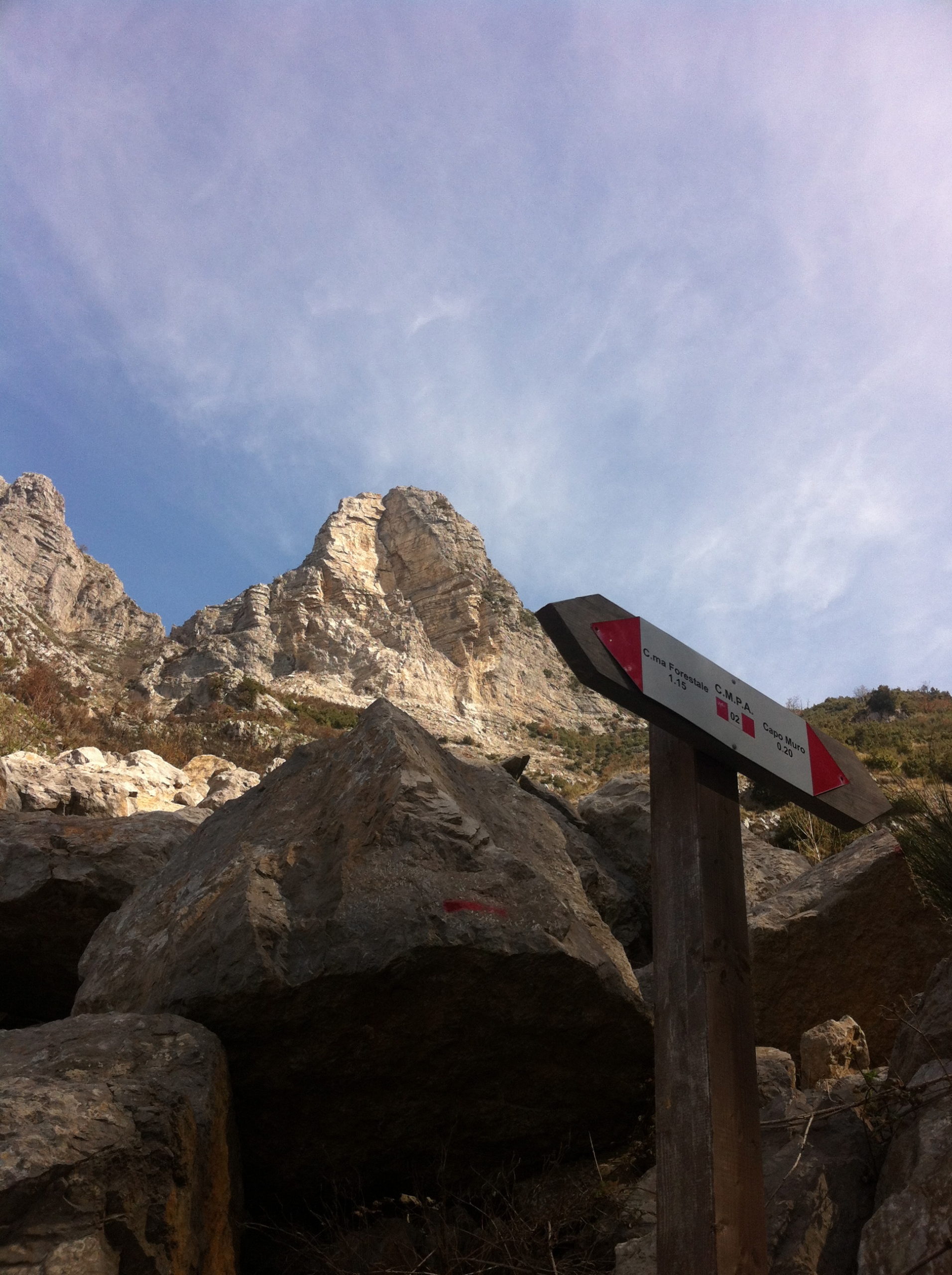
Arrived by car or on foot at Paipo Casino (see Path 2), you climb about 400m uphill along the unpaved road. To the the left, a trail recognizable by red signs painted on tree trunks, descends slightly. Further down, where the path narrows, follow the same red signs painted on rocks. After an uphill stretch of about 200 m, you will to reach a more obvious trail that goes down in the bed of Gradelle Vallone, at the height of a junction signal. Follow the uphill path along the opposite side and, after a very challenging climb, continue for about 700 m. After few large rock stairs you reach a junction after passing a few steps down, steep climb stairs, lead to Vallone Porto gorge. Here you walk over a pile of rubble from a recent landslide collapse, follow the red signs painted on the huge boulders. Reached the opposite side the valley, take the fenced path downhill. After a cypres reforestation area, you will find a crossroads where you must turn left to go down to the Forestry Rangers Barracks (Caserma della Forestale). The path starting in the square in front of the building will lead you , after other reforestation, about 1.5-km high plateau of Santa Maria del Castello.
From here, if you wish, you can go down to Positano along the demanding to the “Le Tese” steps and return to Agerola with the SITA bus. Alternatively, from Forestry Rangers Barracks (Caserma della Forestale), take the path that leads to Montepertuso and, along the Vallone Porto, it joins up with the Path of the Gods, you can follow it to return to Agerola.
There is also a possibility of an alternative path from Forestry Rangers Barracks (Caserma della
Forestale) which climbs to the Cross of Conocchia (1377 m) (CAl Path 300).
Values and points of interest
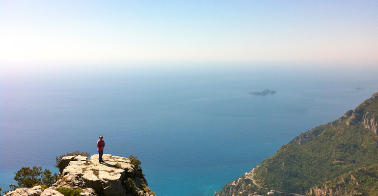
The main values of this trip, beyond the “sporty” one, are those related to the views and landscape.
As for views, please read the description for Path 1, which, in fact, runs almost in parallel, the higher elevation of this path makes even more extensive views of the coast between Vettica Maggiore, Positano, Punta Campanella and Capri. On the southern side you overlook the Gulf of Salerno, with the islets of Li Galli almost at your feet and the horizon delimited by the Cilento promontory..
Moreover, once at S. Maria del Castello, the view to the north, takes in the entire Gulf of Naples with its islands, the Phlegrean hills and Vesuvius.
In addition to these long distance views, the route also lets you enjoy striking observation on tectonic escarpments (see par. 2.2) with which the mountains, you are crossing, ” dive in the sea”.
From Campo dei Galli, looking toward NO, you see the geomorphologic point to which Monteper-tuso (hole in the mountain) owes its name; a sharp limestone spur pierced by a large cave.
Looking, however, upwards, you can admire the rocky cliffs and towers (early Cretaceous limestones) which culminate with the various peaks of M. S. Angelo a Tre Pizzi. From the most eastern of them, M. Catello, a few years ago came off an immense landslide of which we still see the scar.
Across the top of the Vallone Porto, you pass over a stone path twith big and small blocks, which accumulated here as a result of the great landslide. Going into its mouth, the Valley narrows to become a spectacular gorge with vertical sidewalls of high ecological value, which ends on the beautiful secluded beach of Arienzo.
As far as the vegetation found along the way, we like to point out the chestnut coppice in the initial section, the mixed woods that dot the intermediate part and the pine and cypress reforestation in the final stretch.