MONTE CERVIGLIANO E GEMINI
Hike through an area rich with spring waters, winding along Agerola’s most important reservoir. Along the way there are beautiful-views-as well as of course various springs geological values, ancient ruins, traces of industrial archeology and variegated flora.
FROM CAMPORA TO MONTE CERVIGLIANO AND GEMINI
Path information
In front of the Sports Palace (Campora) take via Inserrata and after 600 m, at a junction turn right, uphill. Passing the last houses, cross a centuries-old chestnut grove. Upon reaching Fiobana, you can see towards the bottom to the left, the ruins of a Bourbon period small powder magazine. Continuing to climb, you reach the quiet Panoramic street, follow it to the left for about 100 meters, you reach the small bridge over the Rio Penise. Without crossing it, turn right following the river bed, until you find a stony path, along which are water collection containers. Climbing up facing it you get to cross the CAl trail 301, which must be followed to the left. After about 250 meters you reach the mule track intersection of the Imbarrata, where you will follow the CAl path 300 to the right for 1.5 km, passing the Gavido water spring . Once you reach a grassy clearing, you leave the CAl trail 300 and turn left.
You will soon reach the edge of a cliff with views towards North. Here you turn left, but maybe you should go to the right to a visit to the nearby Vrecciaro water spring , so called because of the scree (brecciaio). Climbing back up from the spring, keep right and continue along a mountain path that bypassing Mount Cervigliano, touches the San Giuliano Cold Water Spring and, until returning to the intersection of Imbarrata.
Here you turn right and follow the crest of St. Angelo Hill for about 1 km. Crossed an exposed area (Palombelle pass), we arrive at the ruins of St. Angel a Jugo (see Path 7 on the Chart), where you turn left, on the old mule track with steps leading down to Gemini (CAl Trail 367), near the tunnel ( “The Traforo l”, as more commonly known) of the Provincial road for Gragnano.
Values and points of interest
This trail runs along the most important agerolese watershed area; along its path, you meet numerous springs that feed the Penise Stream, the Canneto Stream and the Gragnano Stream.
The presence of water facilitates a very varied vegetation growth and the presence of aquatic fauna (spotted salamander, frogs, water snakes, etc.., as well as badgers, foxes, weasels and wild boar.
Between Campora and the upper Penise valley, crossing three different land use bands since the Middle Ages (see par. 2.6): human lodging, chestnut groves and woods. In the first part you can see the ruins of ancient shelters, as well as the ruins of a Bourbon period powder magazine. The springs in the area of Fiobana (a name that comes from fluvial / flubio) are related to the presence of impermeable layers (greenish marl) of the medium Cretaceous limestones. Shortly after the Imbarrata observe an old ice making hole (see par. 2.6), while in the area of Gavido Water, there are the ruins of a seasonal mountain house. The summit of Mount Cervigliano is a fine example of tectonic klippen (see par. 2.2) whose plan of overlapping is visible where the l’Acqua Fredda flows and at other points around
950-1000 m altitude. It crosses Cretaceous limestone shales and Miocene sandstones which can be seen, for example, in the clearing above the Vrecciaro Water, at Gavido Water St. and at the S. Giuliano.
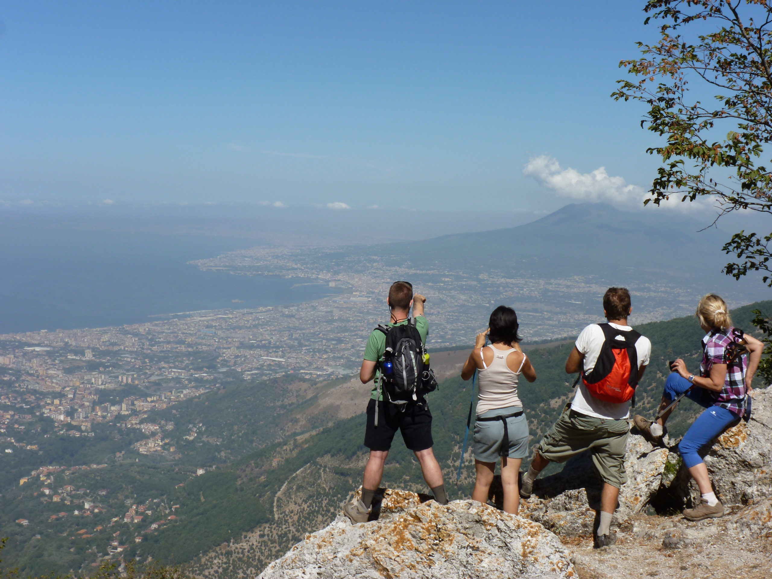
From the Vrecciaro water area up to the ruins of St. Angel a Jugo (see Path Chart 8) you will enjoy beautiful views of the Gulf of Naples and Mount Vesuvius. Finally, coming down from the ridge at Gemini, you walk on a beautiful mule trail of local limestone steps, the main link between Agerola and the Neapolitan side, before the opening of Palombelle gallery (see Path 8 and cf. par. 2.5).