MARINA DI PRAIA
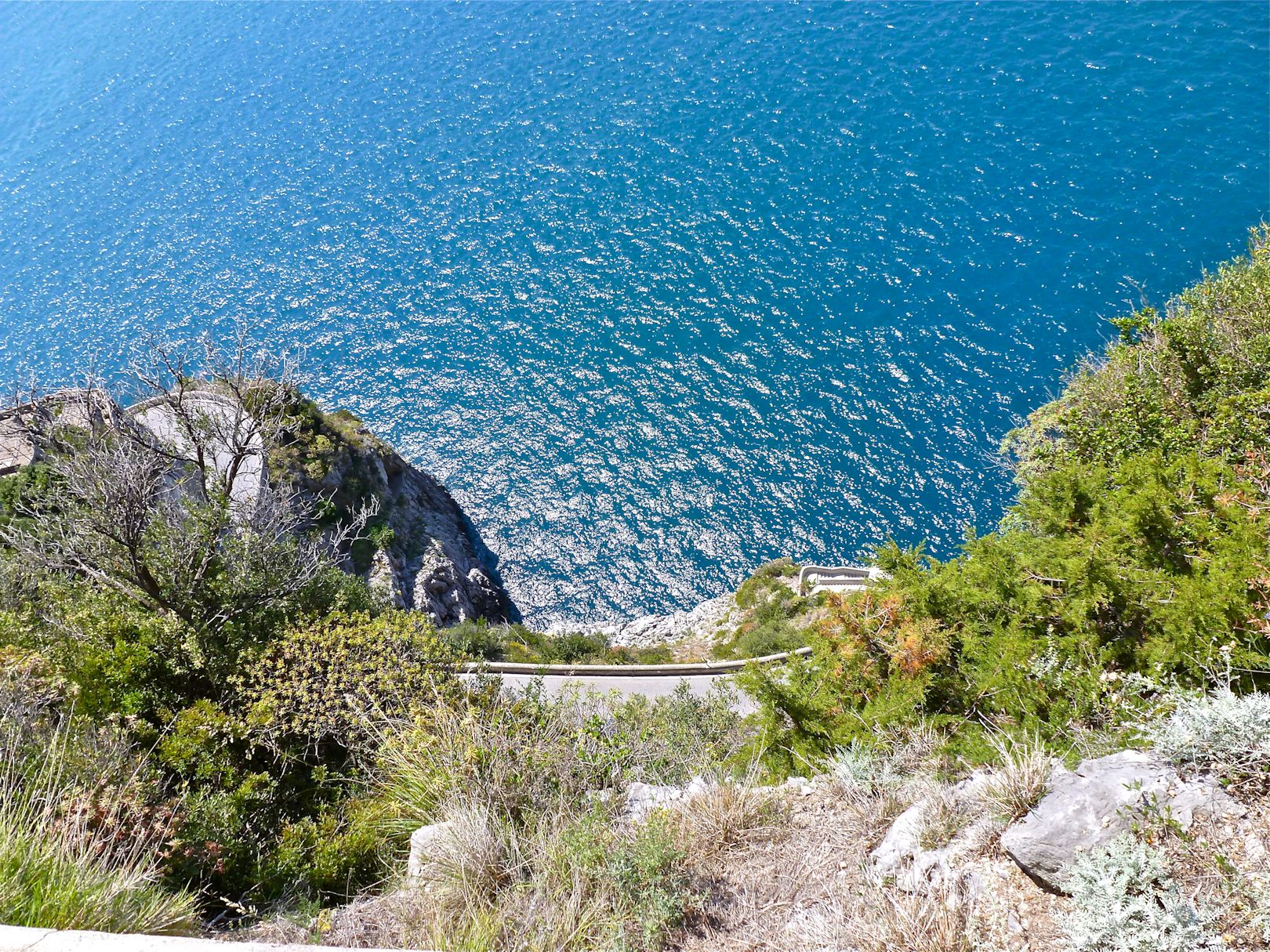
A pleasant walk downhill, passing through a quite valley rich in Mediterranean vegetation, to arrive at a picturesque bay between the cliffs of Marina di Praia, perhaps to bathe or to taste some fish.
A pleasant walk downhill, passing through a quite valley rich in Mediterranean vegetation, to arrive at a picturesque bay between the cliffs of Marina di Praia, perhaps to bathe or to taste some fish.
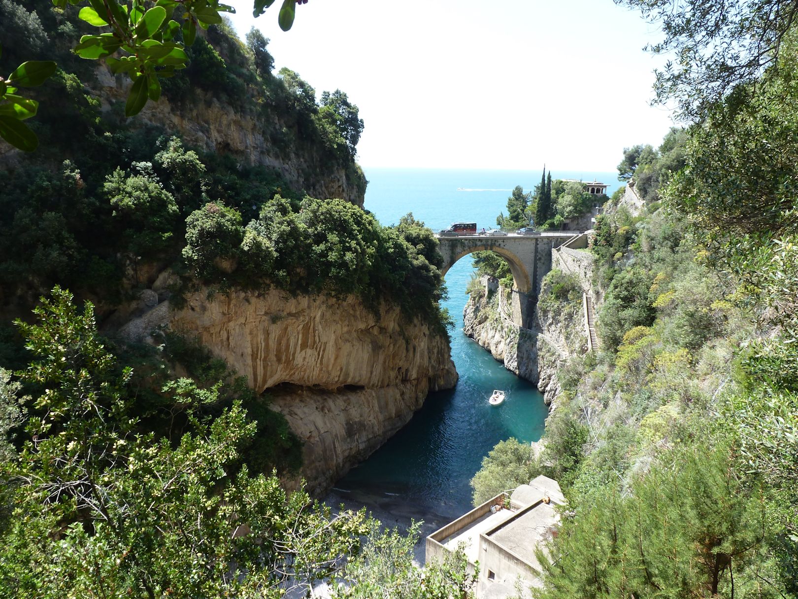
A variant of Path 12 that, between steps and little streets, passes through the scattered village of Furore and reaches its 'ford', to admire the natural beauty and visit the characteristic fishing village and its ancient water mills.
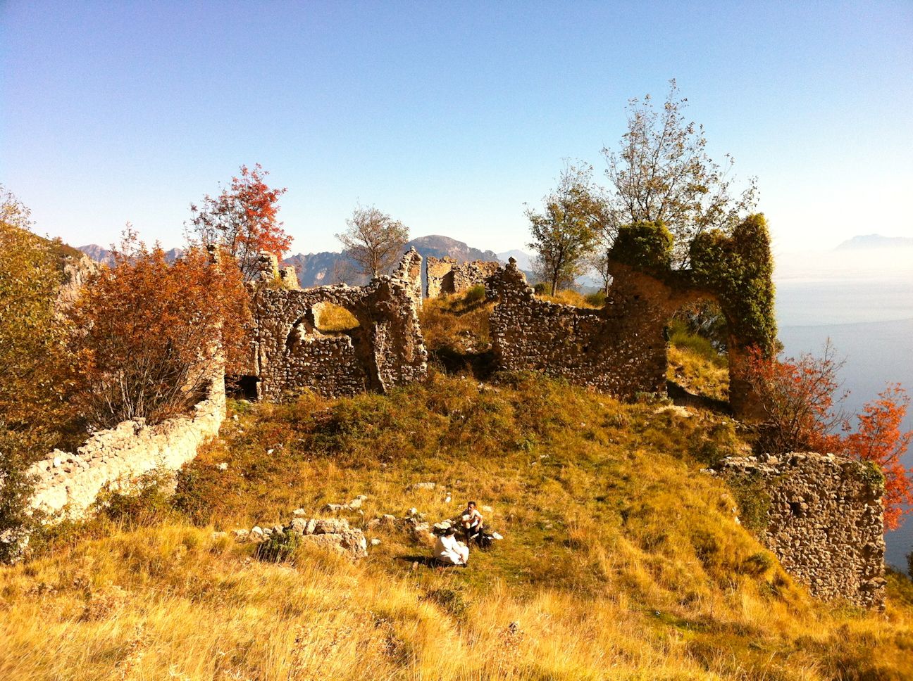
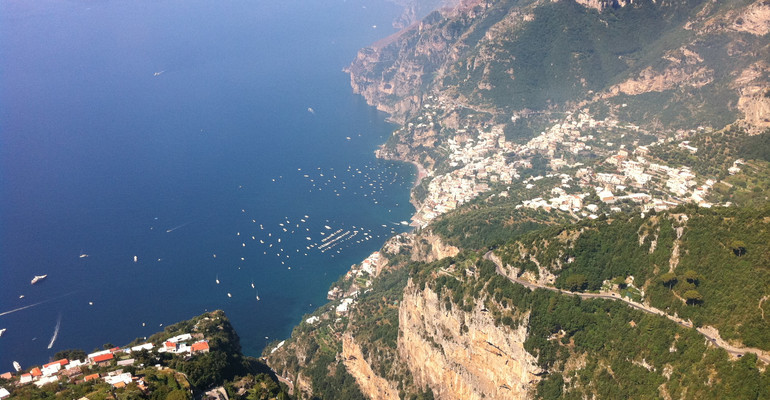
A moderately difficult path that goes over Mt. Murillo and takes you to conquer a fantastic view that falls sheer into Amalfi and its surrounding area. As well as the romantic ruins of a isolated medieval convent abandoned during the 19th century, that later became refuge to bandits after the unification of Italy.
Long but easy hike that leads to the high plateau, (around a thousand meters of altitude) which separate Agerola from Scala and Ravello, two of Amalfi Coast historical and artistic jewels which are reached after having admired them from above. Along the way are sweeping views of the Gulf of Salerno, of crystal springs, cool woods and grassy open spaces that in spring are blossoming with flowers.
Hike through an area rich with spring waters, winding along Agerola's most important reservoir. Along the way there are beautiful-views-as well as of course various springs geological values, ancient ruins, traces of industrial archeology and variegated flora.
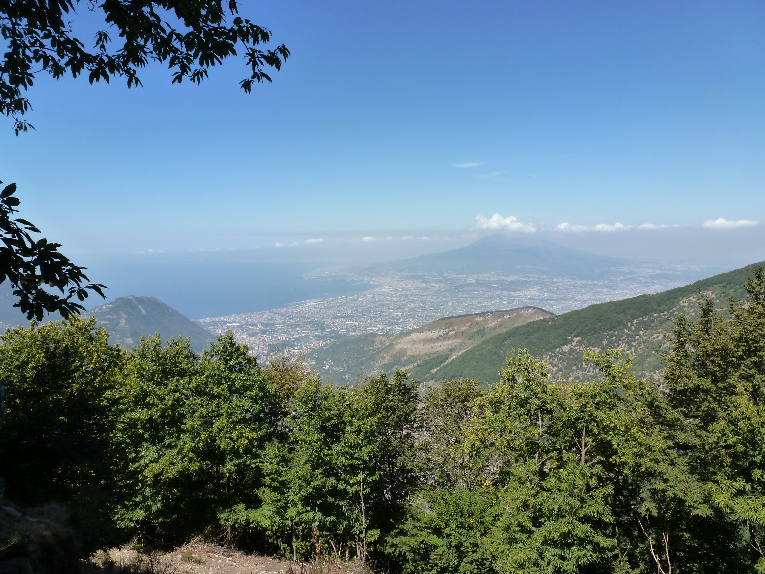
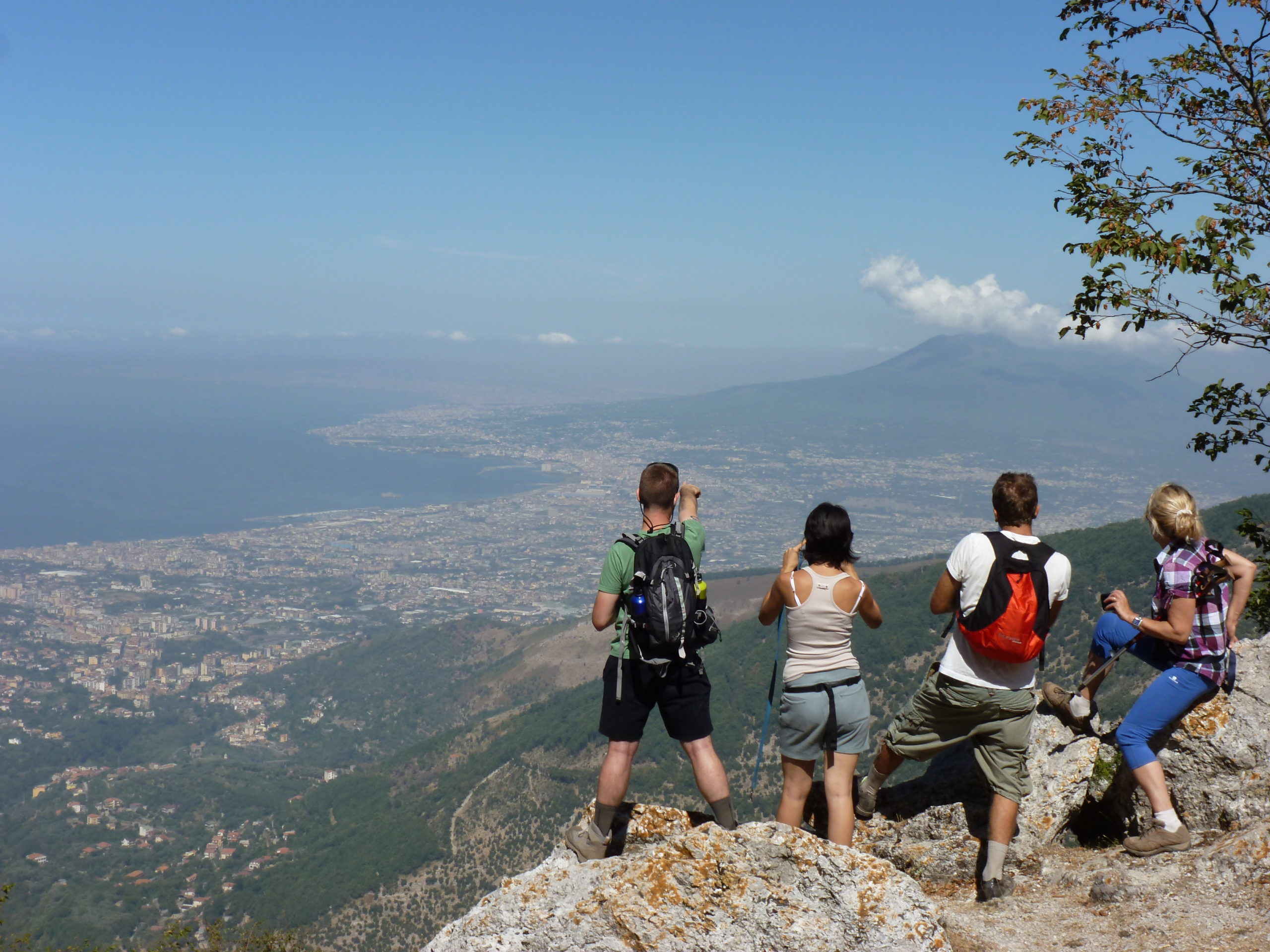
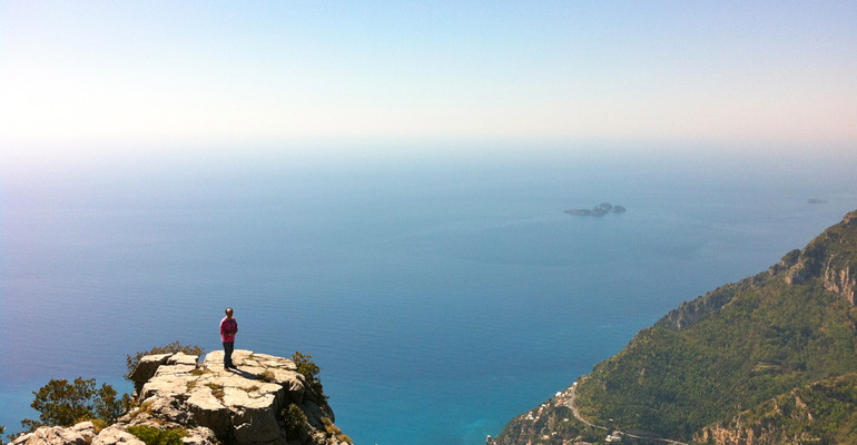
Easier than the previous, but for still for experienced hikers, this path brings on top of Naples Province highest peak (1444 m) with a spectacular 360-degree view of Campania, after a journey rich with geological, botanical and historical suggestions.
A climb for experienced hikers carrying on the pointed median peak of the Tre Pizzi (1350 m). The effort is paid off by the geological botanical high value of the path and , above all, by the stunning views, of large part of Campania, you will enjoy from its summit
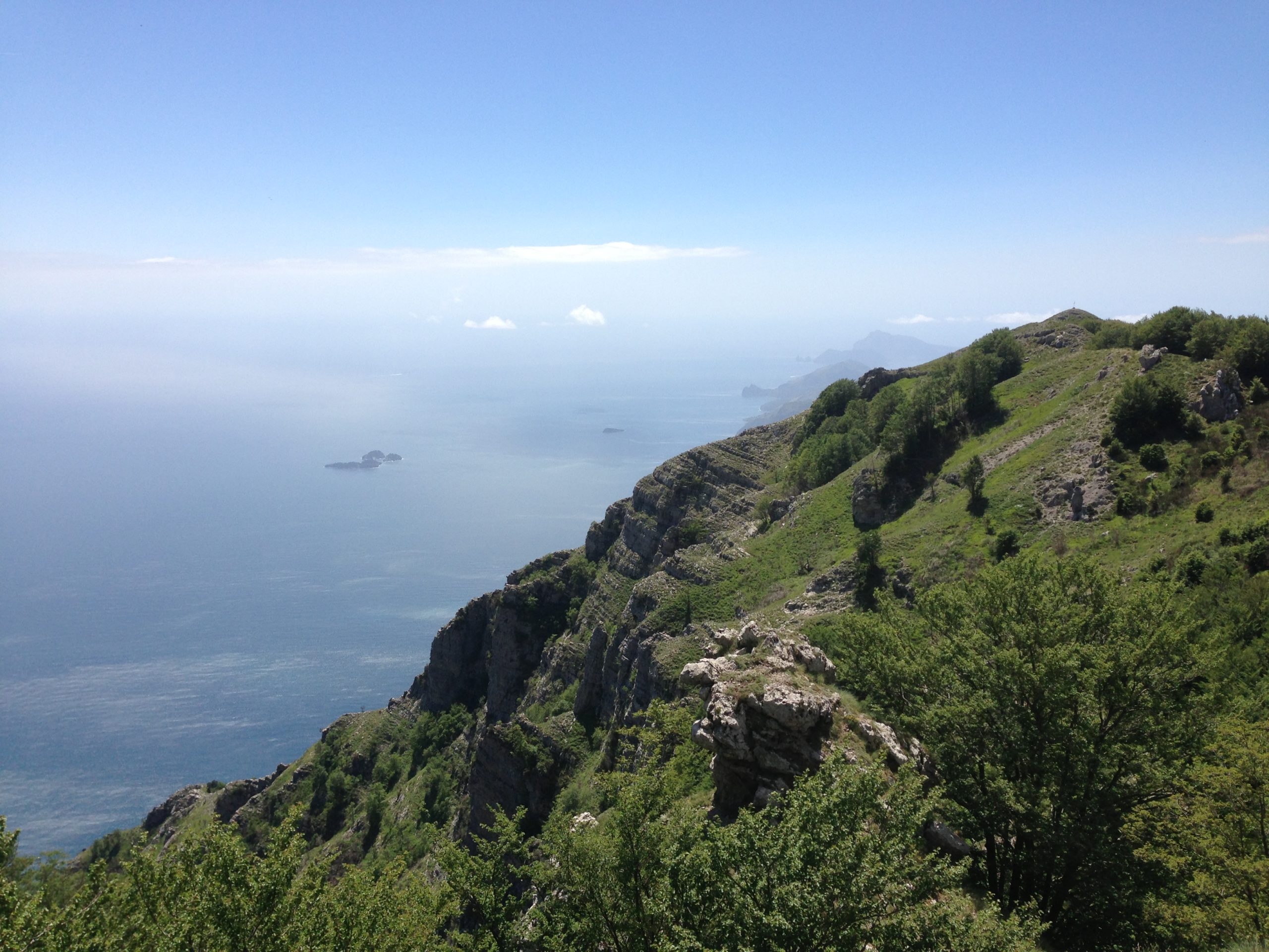
Path of outstanding natural beauty overlooking the coast between Positano and Praiano running parallel to Path 2, from about 850 to 650 m. Along the way you will see the impressive residue of a large landslide collapse, the jagged peaks of the M. Tre Pizzi and striking vegetation changes.
In Piazza Unità d'Italia (former Town Hall square), is the old town hall, recently restored and renamed the Court House. The historic building now houses the city council chamber, the historic section of the city library and spaces and it is used for the artistic Agerolaarte exhibitions. In the same building there is the Ethno-Antropological Museum, a significant space in which are stored all the symbols of Agerola historical memory. This urban route is characterized by its strong historical meaning, from the Museum and onto a narrow road that runs through the historic Via Roma street, one arrives at the thirteenth century St. Peter the Apostle Church. Inside a chapel that houses the statue of St. Anthony, Agerola's patron saint, and eighteenth and nineteenth centuries works of art. Leaving the church, going back a few steps, a typical country lane begins in a portico, then continues lined with orchards and vineyards, up to the Church of Santa Maria La Manna, with a precious marble statue. Continue down to the junction and walk along Via Croce, the ancient road connecting the two villages of Pianillo and Santa Maria, which still retains traces of rural architecture and along which you can see the façade of the church of Santa Croce, dating to the seventeenth century. The path ends back in Piazza Unità d'Italia.
© Copyright 2026 | All Rights Reserved | Powered by Connectivia S.r.l.