MONTE SAN MICHELE
Easier than the previous, but for still for experienced hikers, this path brings on top of Naples Province highest peak (1444 m) with a spectacular 360-degree view of Campania, after a journey rich with geological, botanical and historical suggestions.
FROM SELVA CARBONE TO MONTE SAN MICHELE
Path information
The path starts off via Locoli, just before the Abattoir ( slaughterhouse), where there is a small yard with a trellis.
Here, take a steep path to the right and go past the houses and in rapid succession stables, and terraces.
Continue up the trail that leads after about 1km to the border between Agerola and Pimonte, at the site of Crocelle (altitude 1002 m). Here turn left, and follow a trail between chestnut groves for about 700 m.
Near a small crossroads, bordered by a large rock with red signs, turn right. Here runs the North side of M. S. Angelo a Tre Pizzi path, along the “Malo Passo”, always keeping to the left and neglecting the small deviations that descend from the main trail.
After 1 mile, passing a stretch lined with wood handrails, the trail becomes very evident on the rocky slope, follow the trail signs affixed first on tree trunks and then on the rock. After a short climb, you reach a wider path and after another 200 meters you will reach a a junction where you turn left uphill path under large beech trees. After the cave from where flows the spring of Acqua Santa, and continuing on zig zag stairs, you encounter a fork to the right that leads to the Cross of Conocchia (panoramic western spur of the Tre Pizzi to which, if you wish, you can make a small deviation). Without deviating at the said junction, you reach in just a few minutes a characteristic passage between the rock spires, which mark the dividing line between North and South sides of the massif. Keeping to the left, you reach the base of the “Molare” (a.k.a. M. Saint Michael, the highest peak ), on top of which you can climb through a steep rocky staircase.
Values and points of interest
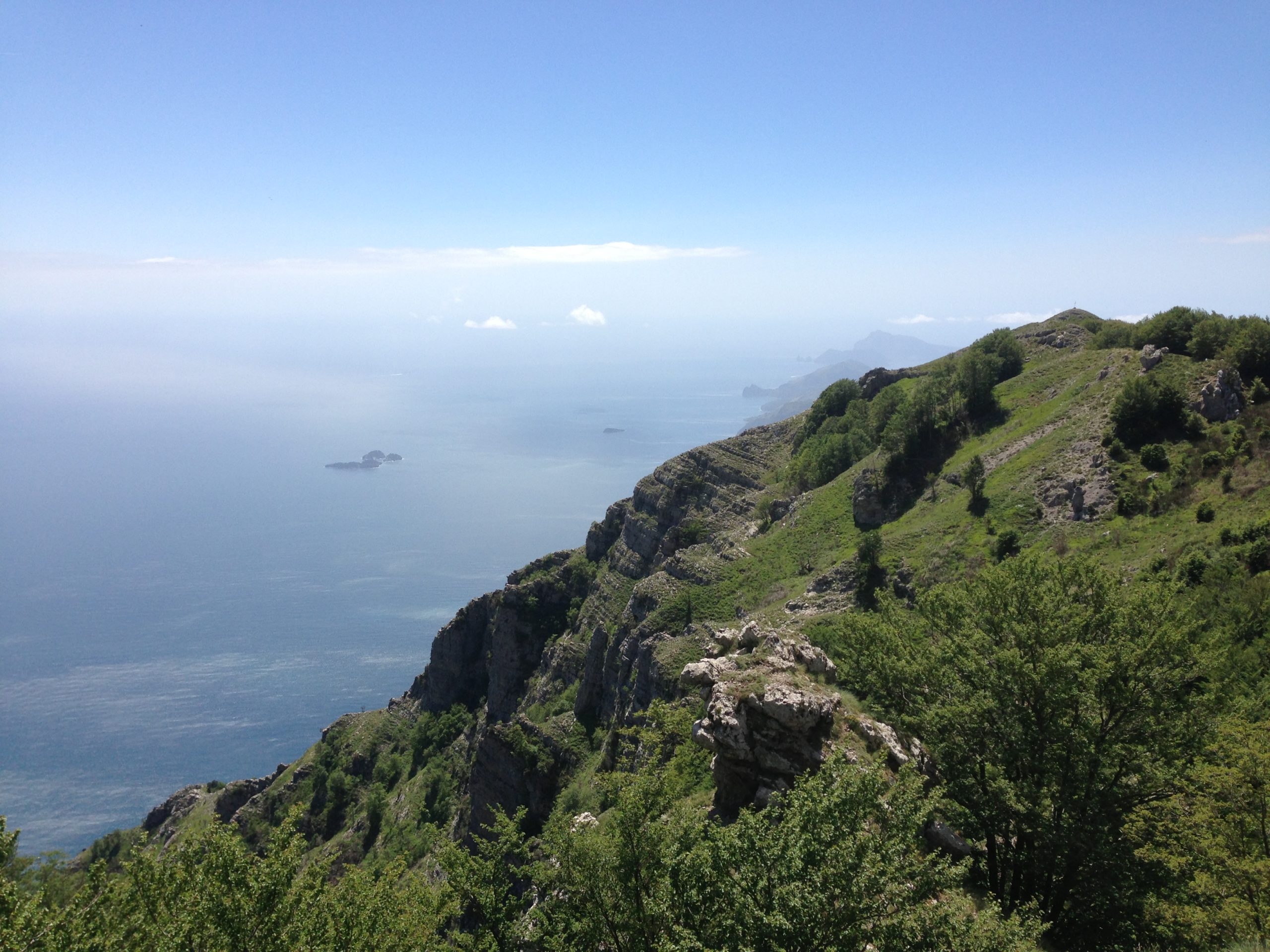
The initial part of the path walks through chestnut and mixed deciduous woodland, while at your back you have have a good view of Agerola valley. Once on the ridge, where you may find wild carnations blooms, the view opens also to the north, showing Pimonte basin, the plain of the Sarno and the unmistakable silhouette of Vesuvius. The trail climbs along the northern side of the Tre Pizzi on marine limestone layers of the Cretaceous displaying a vegetation contrasting with that of the south side. Beeches, some of them centuries old, dominate here instead of oaks. The cave of Acqua Santa (Holy Water) is linked to a medieval legend, according to which the devil had settled here, but he was driven away by S. Michael the Archangel, with three long jumps the devil overcame the mountains and fell in the Gulf of Salerno, while the Archangel, as a reminder of that victory, pierced the rock with his sword and made the spring flow.
In the seventh century, these peaks witnessed the hermitages of S.Antonino (now the patron saint of Sorrento) and S. Catello (patron of Cast.mare of Stabiae.
Just on top of the Molare they built a temple dedicated to St. Michael, destroyed by centuries of ravages and rebuilt in the twentieth century, on a peak between here and M. Faito.
The highlight of the excursion are the wonderful views enjoyed from the peak: down to the south, Positano with its gulf and Li Galli islands, westward the whole Sorrento penin-sula, to the north, the whole Gulf of Naples, with its islands with Vesuvius to the east and finally, the other peaks of the Lattari.. But if the air is clear, the view is much broader and embraces the horizon which goes from the mountains of Gaeta-Formia to southern Cilento
(M. Bulgeria), through the shapes of bluish Matese, Taburno-Camposauro, mountains of Nola, Avella and Sarno, of M. Picentini and the Alburni and Cervati massive.