SANTA MARIA DEI MONTI
Long but easy hike that leads to the high plateau, (around a thousand meters of altitude) which separate Agerola from Scala and Ravello, two of Amalfi Coast historical and artistic jewels which are reached after having admired them from above. Along the way are sweeping views of the Gulf of Salerno, of crystal springs, cool woods and grassy open spaces that in spring are blossoming with flowers.
FROM GEMINI (PIANILLO) TO SCALA AND RAVELLO THROUGH COLLE S. ANGELO AND S. MARIA DEI MONTI
Path information
Near the entrance of the tunnel for Gragnano (Gemini site), take the road on the left (via Traforo), and after about 30 meters, turn left on a steep uphill path that soon becomes a paved trail with stone steps.
Following it all, up for about 250m you will reach the main mountain ridge, near the ruins of St. Angelo a Jugo. Here it intersects the High Lattari Trail (CAl 300). Continue to the right along a larger dirt road.
At the junction about after about 800 m, continue to the right, on a track uphill through a chestnut grove, track which later has cemented stretches. About 1 km further, at a junction, bear left, continuing on the large dirt road along the fence of the Valle delle Ferriere Reserve.
After crossing M. Cervigliano, at a second junction, keep right, following the trail that crosses the Plain of Ceraso, until you reach the plateau of Santa Maria dei Monti and, therefore, a small altar, from where start the downhill stairs to S. Catherine of Scala, where you continue until you reach the road junction Scala-Ravello.
To return to Agerola you can take a SITA bus, with connection in Amalfi.
Values and points of interest
Before you take the path, you can go to the nearby entrance of the 18th century tunnel (to the right of the new one) to see the ancient building techniques. Starting on the path and past the last houses, you are walking on the best example of how large and well refined were the main mule tracks, when from Maritime Republic times to the opening of modern roads -they represented the only means of connecting the various centers. You arrive on the ridge near the last few remains of the church of S.
Angel a Jugo, which also acted as a lookout to observe alarm signals from the castle of Pino and pass them on to Amalfi (see Path 6).
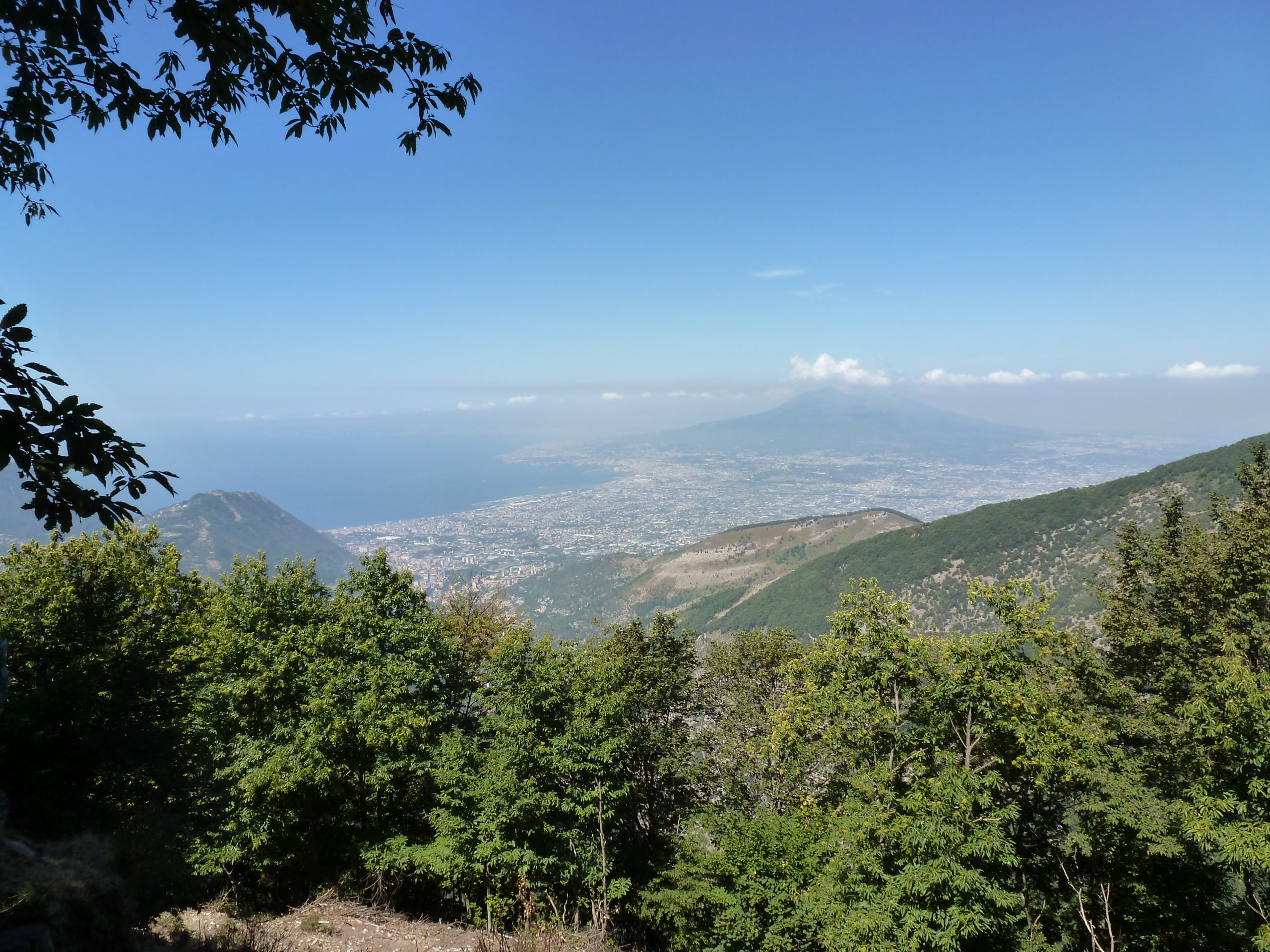
Following the ridge you will admire the view towards Naples, the Vesuvius and the Sarno plain (but if the air is clear, even as far as distant mountains of northern Campania). In the section that passes under the summit of Mount Cervigliano you will encounter some water springs caused by the presence of an overriding tectonic limestones of impermeable rocks (see par. 2.2 and v. Path 7). Then you will pass through a landscape of low slope and flat stretches, which was shaped by erosion and karstification before M.Lattari were raised to their present heights (see par. 2.2).
The vegetation alternating chestnut and alder groves and mixed forests in which we find the Hornbeam and the Beech. In the grassy clearings you will observe explosions of bracken fern and in the spring blooming of crocuses and daffodils.
If you are lucky you may observe, flying high in the sky, hawks and buzzards, while you may hear woodpeckers patter and the cuckoo with its original call. Passing through the ruins of St. Maria Monti, our thoughts go to St. Alfonso de ‘Liguori, who came up there to meditate and that from this landscape, crossed by shepherds, probably obtained inspiration for Italy’s most popular Chrismas carol
“Tu scendi dale stelle”
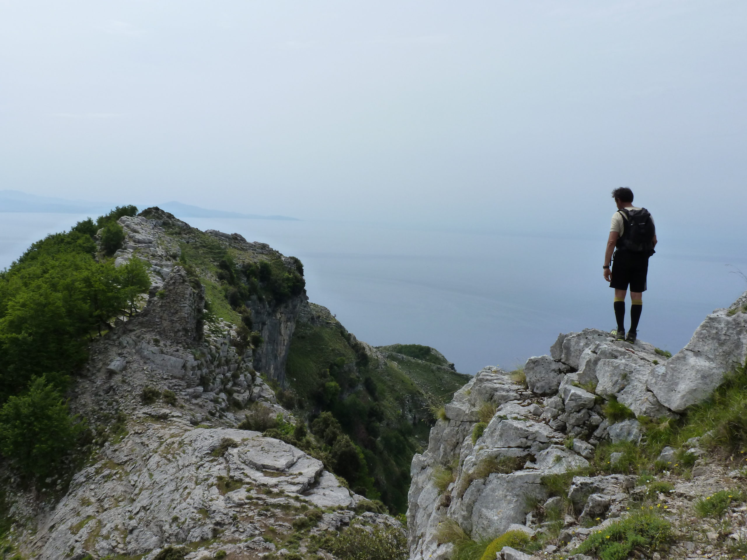
As you descend from the eastern edge of the plateau towards Scala, walking upon layer of marine limestone of the Upper Cretaceous (sometimes fossiliferous), while admiring the beautiful scenic Monti del Demanio (last peaks of M. Lattari before the rear saddle of Cava dei Tirreni), which end in the sea with the rugged Capo d’Orso promontory.
Closer, almost at our feet, are the houses and churches of Scala and Ravello, with the Reginola-Dragon brook’s burrow in the middle.